
Pensiangan: The Remote Heart of Murut Country
Every state has an end of the road. In Sabah it is Pensiangan: the far southern interior where the roads give out, the rivers take over, and the forested hills roll unbroken into Indonesian Kalimantan. If the Murut people have a heartland of heartlands, this is it.
Where exactly is Pensiangan?
Pensiangan sits in the far south of Sabah's Interior Division, right up against the border with Indonesian Kalimantan. Administratively it falls within the Nabawan district, and this is where the confusion comes from: Pensiangan was formerly run as its own district, so older maps, colonial records and plenty of current websites still list it separately. Both descriptions are defensible. If you are filling in a form, Nabawan is the district.
The wider area, sometimes written Pensiangan-Sapulot, covers a stretch of hill country and river valleys with no through roads and very few people. Keningau is the last town of any size on the way in, roughly three hours from Kota Kinabalu, and everything past it gets progressively more remote.
Pensiangan, Nabawan and Sapulot: how they fit together
Three names get used almost interchangeably for this corner of Sabah, which makes planning harder than it needs to be. The short version:
- Nabawan is the administrative district. It is the name on the map and the one in official records, and it contains the other two.
- Sapulot (also spelled Sapulut) is the sub-district and river system where nearly all travel here actually happens. Batu Punggul, Pungiton Cave and Orou Sapulot are all in Sapulot, in the Nabawan district. So if you searched for "Batu Punggul Nabawan", you are in the right place.
- Pensiangan is the deeper southern reach beyond Sapulot, closest to the Kalimantan border, and the most remote of the three.
For a traveller the practical upshot is simple: you book into the Sapulot area, and Pensiangan is the country beyond it that gives the region its character.
The remotest corner of Sabah
Pensiangan sits within today's Nabawan district, beyond Keningau, beyond Sapulot, at the end of rough interior roads that eventually surrender to the river network. For most of its history it was measured in days of travel: colonial officers of British North Borneo reached their little Pensiangan station by longboat, poling up rapids, and considered it the most isolated posting in the territory.
That isolation had consequences that travellers can still feel. While the coasts changed fast, the upper river country kept its longhouses, its Tagol Murut language, its hunting and hill-rice life. During the Konfrontasi years of the 1960s, this border country was patrolled and contested; today it is simply quiet, one of the least visited inhabited landscapes in Malaysia.
River country
Geography explains everything here. The land is a maze of steep forested ridges cut by the Sapulot and Pensiangan river systems, and the rivers are still the true roads: children commute to school by boat, trade moves by boat, and a journey's difficulty is measured in rapids rather than kilometres. Limestone outcrops break the forest in places, the most famous being Batu Punggul, the sacred pinnacle of the Murut, which rises from the Sapulot river country on the way into Pensiangan proper.
The people
This is deep Murut country. Villages along the rivers keep traditions that faded elsewhere generations ago: communal longhouses, tapai jars for every celebration, hunting with dogs and, in memory at least, the blowpipe. Hospitality here is not a tourism product; it is the old law of a hard country, where a traveller on the river was always fed.
How travellers experience Pensiangan
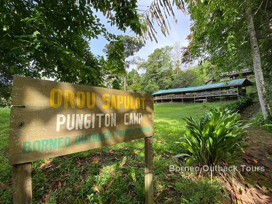
Honestly: through Sapulot. There are no hotels, no scheduled transport and no visitor services in the deep interior, and that is precisely its value. The community-owned operation at Orou Sapulot, run by Murut families from this river system, is the practical gateway: longboat journeys, longhouse nights, jungle camps, caves and the climb up Batu Punggul, arranged from Kota Kinabalu with everything handled.
What you get in exchange for the long journey is the thing that cannot be staged: an interior that never needed to reinvent itself for visitors, because it barely has any.
How to actually get there
There is no airport and no bus that goes all the way. The route is road from Kota Kinabalu through Keningau, then a transfer along progressively rougher road to a river landing, then a longboat. Reckon on most of a day from Kota Kinabalu to a camp in the interior, and a four-wheel drive for the last stretch in wet weather.
Two things are worth saying plainly. First, this is not a self-drive destination: river levels decide what is possible on any given day, and the boatmen who read them are local. Second, access runs through the communities who live here, not through booking platforms, which is why the community-run model matters here more than it does in most places. Getting in without local arrangement is not a matter of being adventurous, it is a matter of not being able to.
Best window is the March to October dry season, when the rivers sit at workable levels. See the month-by-month guide for the detail.
Journeys into the Pensiangan interior run through Orou Sapulot, guided by the Murut families who call it home.
Frequently Asked Questions
Where is Pensiangan?
In the far south of Sabah's Interior Division, on the border with Indonesian Kalimantan. It falls within the Nabawan district, although it was formerly administered as its own district, which is why many maps and records still list Pensiangan separately.
Which district is Pensiangan in?
Nabawan district, in Sabah's Interior Division. The historical Pensiangan district was absorbed into Nabawan, so both names appear in official and older sources. For forms and addresses, use Nabawan.
Is Batu Punggul in Nabawan or Pensiangan?
Batu Punggul is in the Sapulot area, which sits inside the Nabawan district. Pensiangan is the deeper country further south. So Batu Punggul Nabawan and Batu Punggul Sapulot both point at the same place.
What is the difference between Pensiangan, Nabawan and Sapulot?
Nabawan is the administrative district and contains the other two. Sapulot is the sub-district and river system where almost all travel happens, including Batu Punggul, Pungiton Cave and Orou Sapulot. Pensiangan is the remoter southern reach beyond Sapulot, nearest the Kalimantan border.
How do you get to Pensiangan?
Road from Kota Kinabalu through Keningau, then rougher road to a river landing, then longboat. It takes most of a day, needs a four-wheel drive for the final stretch in wet weather, and has to be arranged locally because river levels dictate what is possible.
Can you visit Pensiangan independently?
Not realistically. There is no scheduled transport for the final legs, river conditions decide the route on the day, and access runs through the communities who live there rather than through booking platforms. Visits are arranged with local operators and hosts.
Who lives in Pensiangan?
It is Murut country, and specifically the Tagol Murut heartland, among the communities where longhouse life, tapai brewing and the old dances have held on most strongly. Family ties cross the border into Kalimantan, where relatives have travelled by river for generations.
When is the best time to visit the Pensiangan and Sapulot interior?
March to October, the dry season, when rivers sit at workable levels for longboat travel and jungle trails are in their best condition. The November to February wet season raises the rivers and can close off access entirely.
Related Reading
- Sapulot, Sabah: Complete Guide to Borneo's Hidden Interior
- Who Are the Murut People?
- Sabah Off the Beaten Path
Ready to Experience the Real Borneo?
Small-group jungle, cave and cultural journeys run year-round from Kota Kinabalu, guided by the Murut community of Sapulot.
View Tour Packages WhatsApp Us

.svg)